AEM Elements® 360
Take command of multi-hazard risk management with AEM Elements 360. Seamlessly convert data into actionable insights for more efficient and effective response coordination to natural hazards.

Take command of multi-hazard risk management with AEM Elements 360. Seamlessly convert data into actionable insights for more efficient and effective response coordination to natural hazards.


FORECASt ALERTING
AEM Elements 360 now delivers automated, forecast-based weather alerts that help you act before severe conditions strike. With early warnings based on ENcast® forecasts, real-time updates from the National Weather Service, and AEM’s proprietary Dangerous Thunderstorm Alerts (DTAs), you get precise, location-based notifications across your operations—reducing downtime, improving safety, and enabling confident decisions when it matters most.

Unify environmental data from almost any source for more complete real-time insights.

Create the data views and toolkit you need to strengthen and automate your approach.

Share information across agencies and communities to coordinate a powerful response.

OPTIMIZED DECISION SUPPORT
AEM Elements 360 is a decision support application that transforms the uncertainty of natural hazards into a knowable, manageable situation. The application delivers the unmatched combination of historical, real-time, and forecast weather data that first responders, resource management leaders, and public safety organizations need to prepare for, respond to, and recover from any weather event or natural disaster.

EFFICIENT INFORMATION SHARING
When severe weather strikes, time is of the essence. Sharing accurate information with the right people at the right time is critical to saving lives, optimizing operations, and protecting infrastructure. The automated alerting engine allows users to customize location-based, alerts based on any situation, threshold, or change in conditions and deliver notifications via SMS, email, public web sites, sirens and strobes, and API.

ACTIONABLE INSIGHTS
Eliminate delays due to fragmented data and monitoring disconnected single-hazard applications. AEM Elements 360 easily integrates data from your in-house networks, AEM’s proprietary networks, and almost any other environmental data source for a consolidated view of all relevant hazards and risks.
Transform this diverse data into actionable insights using a versatile suite of configurable maps, charts, dashboards, and analytics for the highest situational awareness for any area of interest.

STREAMLINED COLLABORATION
As environmental hazards grow larger and more expensive, an increasing number of stakeholder teams must come together to prepare for and respond to severe weather and natural disasters. Built to be secure, scalable, and mobile-ready, AEM Elements 360 is specifically designed to enable a breakthrough level of collaboration and information sharing across agencies, businesses, communities, and the general public.

THE ESSENTIAL CLIMATE READINESS TOOLKIT
Natural hazards know no bounds. As businesses and communities try to improve their resiliency in the face of rising threats from multiple natural hazard risks, many of those efforts are being hindered by scattered data, poor coordination across key stakeholders, and limited access to timely warnings. Now there’s a way to enhance collaboration, elevate information sharing, and accelerate response when minutes matter. It’s the AEM Elements™ Resiliency Platform & 360 Application.
AEM Elements 360 is designed to help agencies, businesses, and communities prepare for, monitor, detect, and respond to a wide array of natural hazards. This includes but is not limited to flood early warning, severe weather early warning, wildfire detection and monitoring, post wildfire debris flows, lightning detection, landslides, and climate monitoring. The system brings together historical, real-time, and forecast weather data, providing a comprehensive view of all relevant hazards and risks.
By transforming the uncertainty of natural hazards into a knowable, manageable situation, AEM Elements 360 equips you with the data, insights, and tools needed to make informed decisions. The application provides a unified view of environmental data from almost any source and turns this data into insights via customizable maps, charts, dashboards, and analytics. This enhanced real-time situational awareness makes it easier to understand the full scope of any situation and act accordingly.
AEM Elements 360 can integrate data from virtually any source. This includes your in-house sensing networks, AEM’s proprietary networks, and almost any other environmental data source. This integrated approach provides a consolidated view of all relevant hazards and risks, enabling you to make confident data-driven decisions.
To request a demo of the AEM Elements application, please schedule a consultation here. An AEM representative will reach out to you to schedule a tailored demonstration and help you understand how AEM Elements 360 can meet your needs in managing environmental risk.
Yes, AEM Elements 360 is designed to be compatible with a broad range of sensor suites and data services. It can seamlessly integrate data from your existing sensor or weather station network, providing hyperlocal real-time insights focused on your specific area of interest.
Yes, the automated alerting engine enables users to configure complex alerting criteria based on multiple locations, conditions, and thresholds. The application can deliver notifications to multiple recipients via various channels such as SMS, email, public websites, sirens and strobes, and API. This ensures that critical information is shared rapidly and widely to prompt people to act.
AEM Elements 360 is designed to be secure, scalable, and mobile-ready. This ensures compatibility with a wide range of devices, enabling you to access critical information and collaborate effectively from anywhere.

Keeping your team safe from severe weather is tough when they’re on the move, working in the field, or deployed across multiple locations. Sferic Connect makes it simple. This mobile app delivers real-time weather alerts and live data, empowering your team to monitor conditions, make fast decisions, and ensure safety wherever work takes them.


Receive GPS-based, real-time notifications to stay informed of severe weather threats—right where you are.
Designed for field workers and teams across multiple locations, Sferic Connect ensures reliable access to weather data and alerts.
Access critical weather data in a user-friendly app, with live radar, lightning data, and location-specific forecasts in the palm of your hand.

AUTOMATE ACTION
Free weather apps often provide inconsistent and unreliable reports of current conditions and when storms will arrive. Sferic Connect delivers precise, hyperlocal weather data and forecasts powered by AEM’s global weather networks. Access live radar, lightning, Wet Bulb Globe Temperature (WBGT), rainfall, wind, and more—all backed by thousands of professional-grade weather stations and the Earth Networks Total Lightning Network®, the world’s most accurate lightning detection system. With hourly and 7-day forecasts tailored to your locations, Sferic Connect equips you to make informed decisions and stay ahead of severe weather, no matter where you are.

real-time notifications
Sferic Connect keeps your team informed with GPS-based notifications and customizable alerts tailored to the locations that matter most. The “follow me” feature ensures everyone receives real-time alerts based on their current location, anywhere they go, any time of day. Organizations can also define alerts for specific departments, locations, or weather conditions. Whether monitoring one site or many, Sferic Connect delivers the right alerts to the right people at the right time.

AUTOMATE ACTION
Sferic Connect gives your organization the ability to control when and where weather-related warnings are enacted across all your locations. With a single, reliable source of weather data, you can ensure efficient and uniform implementation of your weather and lightning safety policies. Customize how your team stays informed by defining:
Sferic Connect is available for both Android and iOS devices, making it accessible for teams in the field and on the move.
The “follow me” feature uses GPS on your mobile device to send weather alerts based on your real-time location. This ensures you stay informed and safe from severe weather wherever you go.
Sferic Connect is ideal for emergency managers, construction teams, transportation hubs, school districts, and other organizations with field teams or distributed locations.

The ultimate severe weather visualization, decision support, and alerting tool, with a vast library of weather observation layers.

With sensors in 100+ countries, we provide the world’s most precise lightning network – measuring within 100m of your location.

Quickly deploy an all-in-one weather station and start to collect critical hyperlocal weather information anywhere and anytime you need it.

Call on our 24/7 team of expert meteorologists to access customized real-time weather consulting and storm tracking.
Track weather changes, monitor conditions, and keep a close watch over high-risk locations in real-time before, during, and after an event with our intelligent wildfire software platform.


View and curate sensor and station data, camera images, and video in one wildfire software platform.

Configure advanced calculations and intelligent alerts in our intuitive programming environment.

Edge to cloud data security protects your data and privacy.

intelligent camera technology
Intelligent camera guard tour technology in FTS360 wildfire software so you can easily pinpoint and watch high-risk locations in real time.

Public awareness

custom programming
NodeRED is a visual tool within FTS360 wildfire software that allows users to write, test and deploy custom programs in real-time.

Security and privacy
Edge to cloud data security protects your data and privacy:

Real-time data transmission
FTS invests in high-rate information transmission (HRIT) to ensure GOES data is received within seconds of being transmitted:

Advanced features
Customize to your wildfire software needs with optional upgrades including:

Get exceptionally accurate wildfire weather data. Our Remote Automated Weather Stations are trusted in some of the world’s harshest locations.

The ideal compact and rugged solution for managing hydrology and meteorology environmental parameters.

Confirm wildfire ignition, access imagery with weather overlay data, and see real-time threats to lives and property.

Our compact weather station can be customized to deliver quality, localized, real-time information to support prompt, intelligent decision making.
With sensors in 100+ countries, we provide the world’s most precise lightning network – measuring within 100m of your location.

Webinar
We discuss how wildfires are a major challenge for utilities and local agencies managing Wildland Urban Interface (WUI). This free, one-hour learning session focuses on how organizations are addressing the wildfire event curve head-on with leading monitoring tools and software, including how to:
Storms don’t have to mean delays, downtime, or danger. Sferic Maps gives you the web-based software you need to track severe weather, receive instant alerts, and make proactive decisions—protecting your people, property, and peace of mind.
Access reliable insights from AEM’s global network of thousands of professional-grade weather stations.
Get fast, accurate severe weather warnings, powered by our Earth Networks Total Lightning Network®.
Anticipate and respond to multiple weather threats simultaneously with access to over 80 weather conditions.

COMPLETE VIEW
Sferic Maps provides clear visibility into current and developing weather conditions, helping you stay informed and act quickly. With access to a library of 80+ map layers, you can understand weather impacts like never before.

AUTOMATE ACTION
Whether you’re managing an event, overseeing a facility, or ensuring workplace safety, Sferic Maps keeps you informed even when you’re not actively monitoring the weather. Receive instant notifications through email or text message so you never miss critical updates. Send alerts to a custom distribution list, ensuring that the correct people are informed at the right time. You can tailor alerts to specific weather conditions—such as lightning, Wet Bulb Globe Temperature (WBGT), or high winds—so they align perfectly with your organization’s unique needs and severe weather policies.

MOBILE DATA
Whether your team is in the field, working at multiple locations, or in remote areas, Sferic Maps ensures they can access all their weather data and alerts from any mobile device. Use a web browser for quick and easy access, or opt for the Sferic Connect mobile app for enhanced features like GPS-based alerts and push notifications. Both options deliver real-time updates tailored to the user and your organization’s weather safety policies.

Watch how the county coordinates weather safety information across multiple locations with Earth Networks.

Watch how EANA has created custom lightning alerts for specific distances around their airports.
Sferic Maps is accessible on any web browser, providing flexibility for use on desktop and mobile devices. For teams in the field, the Sferic Connect mobile app is specifically designed for Android and iOS devices, ensuring they stay informed and connected wherever they are.
Absolutely. Sferic Maps allows you to tailor alerts based on specific weather conditions, locations, and organizational needs. You can also deliver different alerts to different user groups, ensuring that individuals only receive notifications when they need to act. This flexibility helps streamline communication and prevent alert fatigue.
Sferic Maps is ideal for any organization that needs to monitor and respond to lightning and severe weather conditions to protect people, property, and operations. This includes emergency management teams, school districts, club and sports managers, event planners, and airlines and airports. Whether you’re managing a single site or a distributed network of locations, Sferic Maps provides the tools to make proactive, weather-driven decisions.
Mobile severe weather hub notifies staff of dangerous weather when and where they need it.
With sensors in 100+ countries, we provide the world’s most precise lightning network – measuring within 100m of your location.
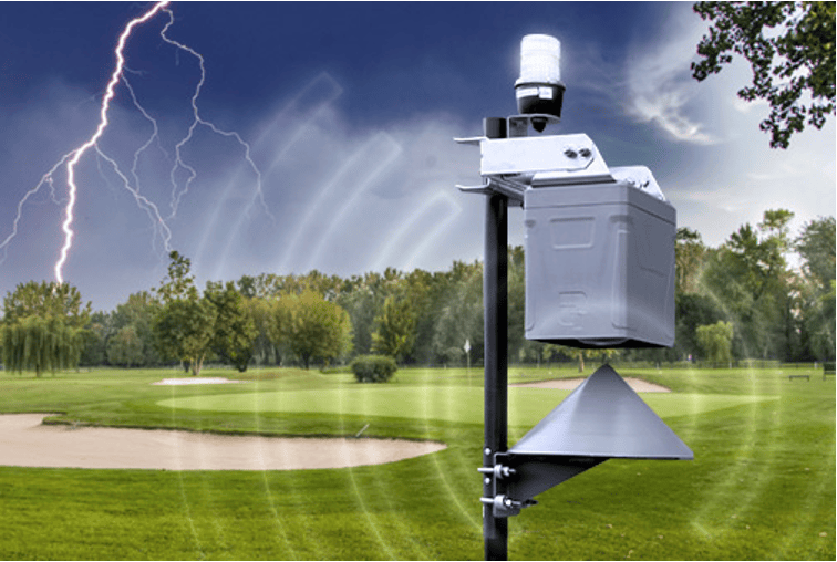
Make sure everyone knows lightning is on the way with our automated outdoor warning siren.
Call on our 24/7 team of expert meteorologists to access customized real-time weather consulting and storm tracking.


