AEM Elements™ 360
AEM Elements 360 is a multi-hazard weather intelligence solution and the cornerstone of the Elements Resiliency Platform.
Over the last two and a half years, AEM has worked with a variety of municipal, regional, and investor-owned energy utilities to protect their infrastructure, customers, workers, and bottom lines from the growing threat of major wildfires. The following story is a composite that represents the full breadth of our rapid transformation capabilities for energy utility providers.
Imagine a member-owned electric co-op in the American west. Given the recent uptick in wildfires across their region, the co-op decided to make a strategic investment in wildfire preparedness, monitoring, and detection in order to better protect customers as well as their substations and approximately 12,000 miles of distribution infrastructure. Partnering with AEM, the co-op’s risk management team built a wildfire monitoring network and automated alerting hub that significantly improved operational decision-making.
Wildfires are substantial threats to a growing number of communities and infrastructure, so it is essential for public power utilities to adopt proactive measures in risk management and mitigation. Wildfire mitigation planning is crucial for public power utilities to ensure the resilience and reliability of electricity supply, reduce risks and associated costs, enhance public safety, and comply with regulatory standards.
Our utility customer needed to grow a modern approach to wildfire risk assessment and detection from the ground up, since they’d never had major worries about the threat of fires until recently. After internal reflection and studying what other providers in the region were doing, their operations department determined the co-op needed a wildfire monitoring and awareness solution that would:
The solution needed to provide a source of truth for wildfire risk assessment, visualization of high-risk areas, and on-going hazard monitoring.
The co-op needed a system that could recognize potential wildfire risk scenarios (smoke, lightning strikes, air quality drops, etc.) and alert human monitoring professionals.
The solution needed to improve the co-op’s ability to coordinate internally and collaborate with wildfire agencies to mitigate potential ignitions before they grew.
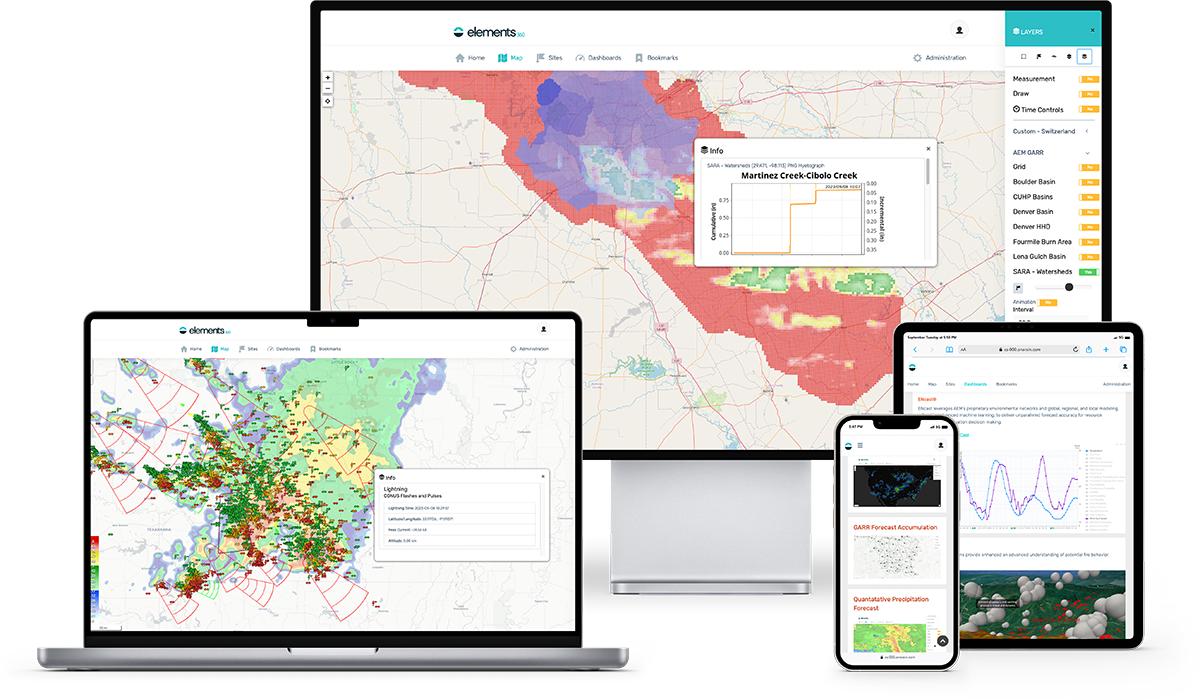
Working with AEM, the co-op carried out a risk assessment of their entire service area and determined the individual facilities and key locations where fires presented the highest potential risk or were most likely. That analysis directly informed the deployment points for weather stations and cameras that would create a fire risk monitoring and detection network. That network sends a wealth of cross-referenceable data points back to a central software hub to create a 24/7 command center for active or passive monitoring.
AEM Elements 360 serves as the backbone of the co-op’s wildfire risk management monitoring, centralizing live camera, weather station, and lightning data in a digestible, visual manner.
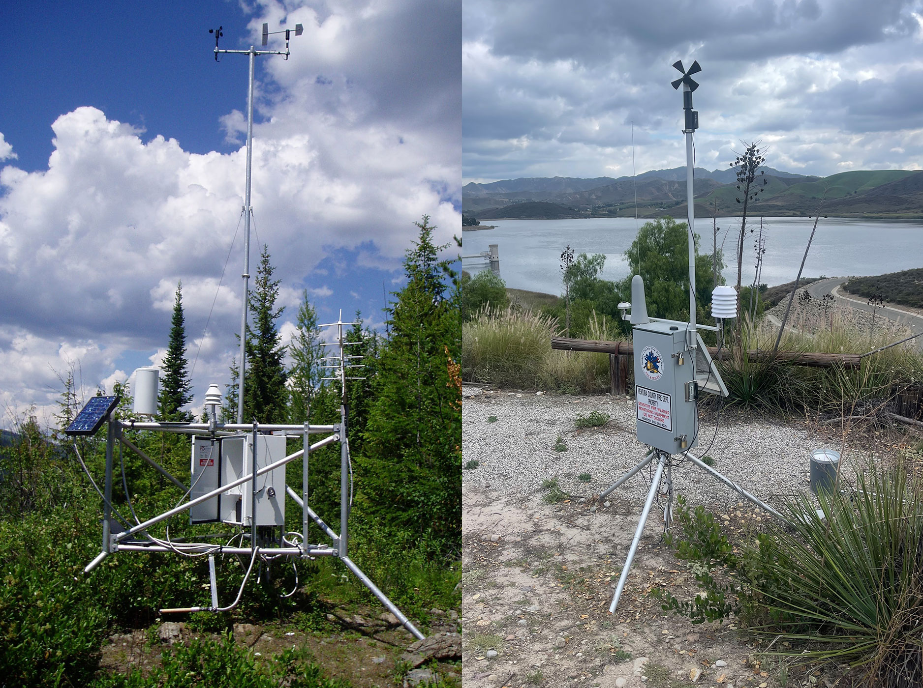
The co-op was able to scale their monitoring network rapidly by leveraging the AEM RAWS, the North American standard for fire weather danger rating.
PTZ cameras provide a drivable, real-time 360-degree viewshed for high risk areas in the co-op’s service area, and the cameras can recognize smoke to provide an automated alert.

The co-op receives instantaneously lightning alerts to help them identify locations of potential ignitions and trigger visual assessment using nearby cameras.

The co-op uses real-time hyperlocal air quality index (AQI) readings to cross-reference potential visual smoke detection and rule out false alarms from fog and steam.
The co-op can view real-time satellite imagery of their service area at any time to visualize hotspots and identify potential ignitions that cameras might be missing.
With their new wildfire risk monitoring and detection network in place, this regional co-op has emerged as a preparedness leader in their state, protecting thousands of square acres of wilderness and tens of thousands of miles of transmission lines from the threat of major wildfires. Using AEM Elements 360, they’re able to recognize and assess potential threats rapidly to turn real-time information from the field into action without any doubts about the validity or interpretation of the intelligence they’re receiving. When wildfires do ignite in their service area, they’re able to collaborate with local county- and municipal-level firefighting teams to coordinate a safe, successful mitigation effort.
All that means they’re keeping their members’ homes and wallets safe than ever before.