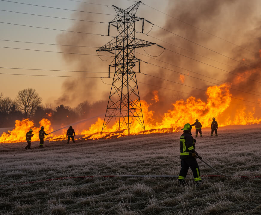
Build total awareness about wildfire risks and potential ignitions to protect natural resources
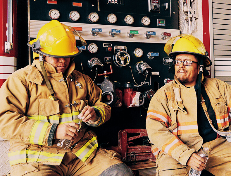
No community or business is immune to the growing threat of major wildfires. We help you stay ahead with tools for early detection, rapid response, and strategic recovery, including tailored solutions for:
Build total awareness about wildfire risks and potential ignitions to protect natural resources
Create a 360° wildfire command center so you can lead, communicate, and make decisions with confidence
Maximize visibility for potential ignitions in your service area so you can protect the grid and community
Understand your wildfire risk profile in depth and share intelligence rapidly with fire teams
Get the data you need to manage wildfire risk and your land in a way that’s consistent with your values and goals
We help wildfire leaders create an always-on, multi-source approach to fire risk management that drastically increases the chances of detecting, responding to, and mitigating a potential ignition before it becomes a problem. As an innovative wildfire partner, we can provide support for any monitoring, forecasting, or operational challenge, but we generally connect people with…

Improve fire risk awareness, danger rating capabilities, and behavior analysis with a dedicated intelligence network
PTZ cameras deliver a clear view of high-risk areas so you can detect threats early and respond faster.
Pinpoint your areas of greatest risk and locations where ignitions might have occurred so you can manage your territory proactively
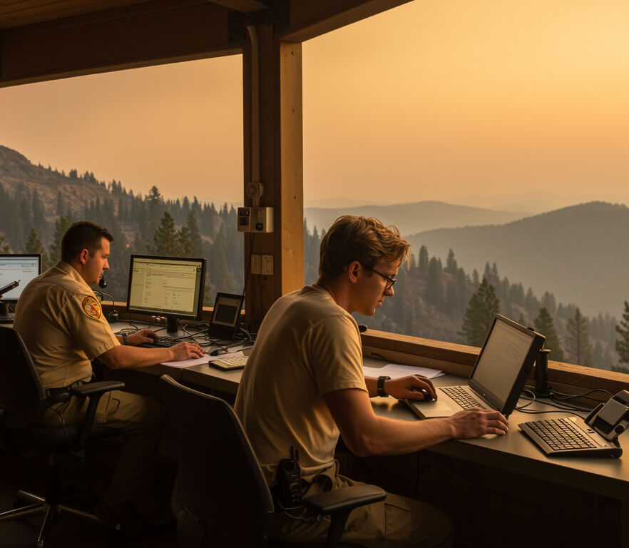
Communicate, collaborate, and coordinate over wildfire intelligence using a single application that’s designed for decision making


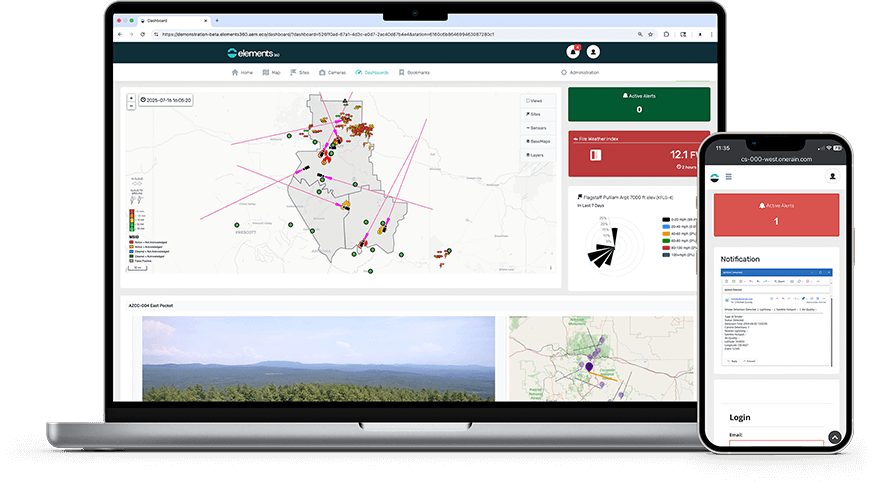 Comprehensive fire monitoring dashboard with real-time and forecast data
Unifies weather, lightning, air quality, fuel satellite, and visual intelligence
Secure and scalable to support interagency collaboration
Comprehensive fire monitoring dashboard with real-time and forecast data
Unifies weather, lightning, air quality, fuel satellite, and visual intelligence
Secure and scalable to support interagency collaboration
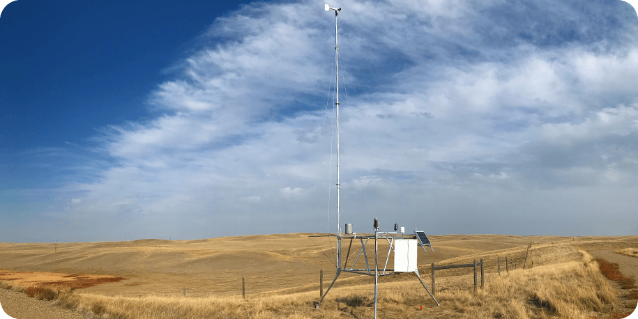 The North American standard for wildfire weather monitoring
Available quick-deploy model for network design studies and fire weather on demand
Flexible communication options for remote or off-grid deployments
The North American standard for wildfire weather monitoring
Available quick-deploy model for network design studies and fire weather on demand
Flexible communication options for remote or off-grid deployments
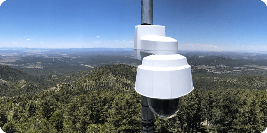 360° viewshed for key locations in the field, with pan-tilt-zoom functionality
SmartGT automated guard tours keep watch across high-risk locations around the clock for early detection.
Sorts images to present them in a clear, digestible way for fire professionals
360° viewshed for key locations in the field, with pan-tilt-zoom functionality
SmartGT automated guard tours keep watch across high-risk locations around the clock for early detection.
Sorts images to present them in a clear, digestible way for fire professionals
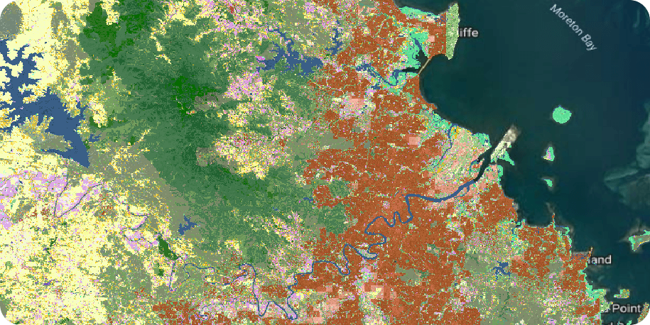 Dynamic, comprehensive wildfire fuel mapping informs models and planning
Data refreshes every 10 days to keep subscribers up to date
Customizable to account for local fuel types, priorities, and topography
Dynamic, comprehensive wildfire fuel mapping informs models and planning
Data refreshes every 10 days to keep subscribers up to date
Customizable to account for local fuel types, priorities, and topography
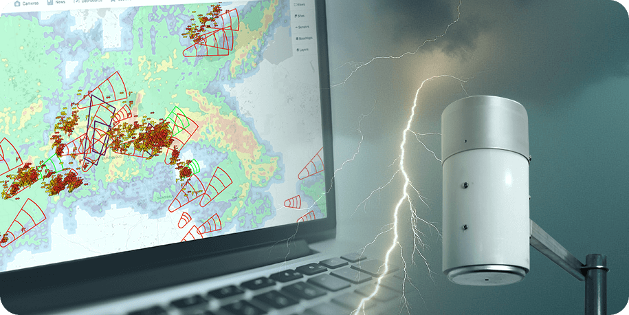 Real-time storm tracking and lightning strike maps
Historical lightning data for research, risk assessment, and planning
Local lightning detection networks
Real-time storm tracking and lightning strike maps
Historical lightning data for research, risk assessment, and planning
Local lightning detection networks
If you’re responsible for a large territory or service area, creating your own wildfire network may be the best way to reduce response time and protect infrastructure or resources. We can connect you with the sensors, software, and network design knowledge necessary to build total fire awareness.
Talk to a wildfire specialistNot sure what step is next for your community? Understand lightning risk in the 2025 U.S. Lightning Report.

“We purchased the QDRAWS just to have for project work like vegetation management. Then we also used it to identify good spots for permanent stations… It’s just been great. It’s easy to deploy. Easy to take down. It’s a great product.”
Kevin VanWig, Captain, Ventura County Fire Wildland & Aviation Division

“It has been great… to facilitate upgrade and enhancement of our network of fixed and portable weather stations across Victoria. This will be invaluable for helping provide better observations of fire weather to inform firefighting operations and community warnings. The [AEM] stations are high-quality and user-friendly stations, being particularly easy to transport, deploy and demobilize…Additionally, the use of soil and fuel moisture sensors on some stations has provided an invaluable source of objective data for helping improve some key gaps in our fire behavior models relating to fuel availability and forest flammability.”
Andy Ackland, Predictive Services Specialist, Victoria Country Fire Authority

“The territory of the Vesuvius National Park is rich in natural resources, the historical ‘cradle’ of volcanology, breath-taking landscapes, age-old cultivations, and traditions that make the Vesuvius area one of the most fascinating and most visited places in the world… Our goal is to prevent and reduce the wildfire risk and consequent hydro-geological risks (soil erosion, shallow landslides, and hyper-concentrated flows).”
Domenico Guida & Antonia Longobardi, Researchers, C.U.G.RI. (Inter-University Research Center for Prediction and Prevention of Major Hazards), University of Salerno

“The ease of working with AEM was very attractive to us… Getting our network up and operational was a very quick process... The way that AEM is working to add additional technologies to their camera network and always looking to bring more things to the table is key for us.”
Pam Feuerstein, COO, CORE Electric Cooperative
Keeping communities in the wildland-urban interface safe from wildfires requires an incredible variety of reliable, trustworthy data to inform decisive action. We help local governments and emergency management leaders ingest, combine, and compare a large amount of data in a clear, event-specific, action-oriented way.
Click the circles on the map below to learn more about the wildfire intelligence and technology protecting this model community.
Nothing can replace having eyes on the field, and PTZ cameras enable ongoing guard tours that automate visual fire monitoring.
Weather stations in the field help calculate reliable fire danger ratings and provide a real-time glimpse into conditions like wind that could affect fire.
Surface scans of the forest from satellites can identify potential fires that might not yet have been detected by other means, enabling timely response and limiting their impact.
When you’re monitoring the woods, it’s crucial not to misidentify smoke as fog, and once a fire has begun, air quality becomes a major concern for response professionals and the public.
Knowing about a lightning strike in a dry area can enable a timely assessment and mitigation effort to minimize the spread of storm-related wildfires.
Weather stations on both public and private land provide real-time wind and weather data to predict fire behavior and keep people safer. We recommend the Vantage Pro2™.
AEM’s signature multi-hazard decision support software allows this community’s emergency leadership to view all their critical fire and weather data in one place, creating a comprehensive collaboration hub.
AEM delivers an integrated platform spanning the entire wildfire event curve—prevention, detection, response, and recovery. AEM Elements 360 unifies weather data from Remote Automated Weather Stations (RAWS), 360° pan-tilt-zoom cameras, lightning data, satellite heat signatures, fuel and air-quality layers, and professional services (network design, installation, maintenance). The result: better situational awareness, faster wildfire detection and response, and reduced loss.
Customers include municipal and state fire departments, federal wildfire agencies, electric utilities, and public/private land managers across North America. These organizations use AEM to shorten detection-to-response time and protect people, infrastructure, and natural resources.
AEM Elements™ 360 aggregates forecasts, fuel moisture, and air-quality metrics into one highly visual dashboard. This enables faster, evidence-based decisions. See how Multi-Source Ignition Detection combines a variety of real-time data sources to transform AEM Elements 360.
Fixed cameras continuously monitor a defined high-risk area with low power needs. PTZ (pan-tilt-zoom) cameras deliver 360° guard tours, optical zoom for confirmation, and dynamic scanning of wide territories. Most networks blend both: fixed for critical infrastructure; PTZ for broad situational awareness.
Yes. Solar-powered fixed and PTZ units with battery backup operate where no utility power or internet connectivity exists. Lightweight mounts enable rapid deployment, and integrated connectivity streams data directly to AEM Elements™ 360.
AEM provides end-to-end services: risk analysis, network design, permitting assistance, professional installation, 24/7 monitoring, and ongoing maintenance/SLA support. This ensures optimal coverage, uptime, and measurable ROI. Speak to a Wildfire Risk Management specialist.
Wildfire DaaS supplies 20-meter resolution fuel and vegetation layers updated every 10 days (150+ fuel types). Agencies ingest these dynamic datasets into fire spread models for more accurate rate-of-spread, intensity, and resource allocation forecasts. See the most advanced wildfire fuels data available.
Have questions about anything you’ve read? Ready to see how AEM’s Wildfire services could improve wildfire resilience in your community? Fill out the form below to get a conversation started.


