States & Municipalities

Build a community that’s ready for whatever comes your way. Improve warning and response times for floods, wildfires, lightning, and other severe weather events. Get data insights to guide infrastructure planning and budgeting. Strengthen collaboration around weather and water.

Top insights

1 / 3

AEM is here to help you protect your community

Action-oriented software

Our AEM Elements® 360 app provides a single source of truth for forecast and monitoring data.

Multi-hazard expertise

We offer a comprehensive approach to severe weather, wildfire, and flood risk management.

Built for collaboration

We enable interagency collaboration to mobilize weather intelligence when it’s needed most.

We set you up to look weather-wise when the stakes are highest

severe weather preparedness

Improve emergency management and public safety during weather events

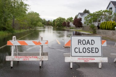
In the event of flooding, wildfires, and other extreme weather, there’s no room for indecision – by acting fast you save lives and protect livelihoods. Accurate, real-time data means you can move early, confident you’ve made the right choice.

Severe weather events, such as hurricanes, tornadoes, floods, or wildfires, pose significant risks to human life. By improving response times, local leaders and emergency personnel can evacuate people from vulnerable areas, provide timely medical assistance, and ensure the safety of residents. Every moment counts in these situations, and faster responses increase the likelihood of successful rescues and reduce the loss of life.

Timely responses enable authorities to implement preventive measures that safeguard critical infrastructure, homes, and businesses. This includes reinforcing buildings, deploying flood barriers, or implementing controlled power shutdowns to prevent further damage. By acting swiftly, response teams can mitigate the destruction caused by severe weather, reducing economic losses for individuals and communities.

Faster response times enable better resource allocation. By quickly assessing the severity of a weather event, emergency managers can allocate personnel, equipment, and supplies in a coordinated and efficient manner. This ensures that resources are deployed where they are most needed and maximizes the effectiveness of response efforts.

mass PUBLIC SAFETY notificationS

Real-time public alert systems


Severe weather events often require evacuation measures to ensure the safety of residents in vulnerable areas. Alerts and notifications help authorities communicate evacuation orders and provide information on available shelters. By promptly notifying the public, individuals can evacuate to safer locations or find appropriate shelter, reducing the potential for harm during the event.

Public safety is a priority when you know lightning, flooding, or other dangerous weather is on the way. We automate alerts to warn everyone affected, letting you shut down operations and move people to safety in plenty of time.

During severe weather events, effective communication is essential for coordinated response efforts. Alerts and notifications facilitate communication between emergency management agencies, first responders, and the public. This ensures that everyone is aware of the situation, understands the recommended actions, and can coordinate their responses accordingly.

MULTI-HAZARD RISK MANAGEMENT SIMPLIFIED

A weather & wildfire partner you can rely on

Our depth of expertise and range of solutions can help you tackle the many emerging threats of extreme weather. And with a support team on-hand to help you make the tough calls, you can be confident handling any weather event.

With more than 17,500 automated weather stations and 1,800 lightning detection sensors across the world as well as the ability to help you make strategic monitoring upgrades, we can build a 360-degree understanding of risks for your specific community.

Severe weather events can vary widely within a single region. Hyperlocal data enables emergency managers and local leaders to assess the potential impact of severe weather on specific areas, such as neighborhoods or even individual streets. This assessment helps in determining evacuation orders, allocating resources, and implementing appropriate safety measures.

Top products for states & municipalities

Elements 360 by AEM is a multi-hazard environmental risk management solution including monitoring, alerting, and collaboration tools.

AEM Elements® 360

AEM Elements 360 is a multi-hazard weather intelligence solution and the cornerstone of the Elements Resiliency Platform.

Find out more

Gauge-Adjusted Radar Rainfall (GARR)

Our unique approach of combining rain gauge and radar data delivers a more accurate rainfall measurement.

Find out more

Vflo® Flood Forecast

Our cutting-edge, physics-based flood forecast model delivers fast, hyperlocal predictions to enhance disaster response.

Find out more

Vantage Flood Station

This cost-effective station provides communities with real-time flood detection and alerts for nuisance flooding.

Find out more

Earth Networks Total Lightning Network®

With sensors in 100+ countries, we provide the world’s most precise lightning network – measuring within 100m of your location.

Find out more

Sferic Siren

Make sure everyone knows lightning is on the way with our automated outdoor alert system.

Find out more

Remote Automated Weather Station (RAWS)

Get exceptionally accurate wildfire weather data. Our Remote Automated Weather Stations are trusted in some of the world’s harshest locations.

Find out more

AI Smoke Detection

Use advanced AI algorithms to quickly and accurately identify wildfire threats before they escalate.

Find out more

Meet some communities that are surviving and thriving

Post Case Study

How QD RAWS Is Helping Ventura County Control Wildfire Risk

To remain aware of where they face the greatest wildfire risk, Ventura County officials have created and continue to expand a network of Remote Automated Weather Stations (RAWS). But network expansion poses a chicken-and-egg problem for the county: how do you identify new at-risk when you don’t already have a fixed RAWS at the site to collect the necessary data? This is the story of how they've solved that problem.

Read more
Post Case Study

Palm Beach County coordinates district-wide weather safety

Watch how the county coordinates weather safety information across multiple locations with Earth Networks.

Resources

Find out how AEM can transform your business

Get in touch