
Apex Flood Station
Advanced flood monitoring and warning for large networks, complex sites, and high-consequence deployments.
Arlington County, Virginia, is working with AEM to strengthen its ability to manage flash flooding and stormwater impacts by expanding its network of high-water detection and monitoring stations across the county. Through expanded observation and real-time dashboards, they are building the foundation needed to improve roadway safety, calibrate watershed models, and support proactive infrastructure planning.


“We are implementing the system to be proactive and armed with data.”
As flooding risks increased, Arlington faced critical observation gaps that made stormwater decision-making more difficult.
Arlington previously only had a single public USGS station which provided only limited understanding for how rainfall and flooding varied across the County.
The County uses advanced hydraulic modeling tools, but they needed real observation data to validate the models at the watershed level.
Major storm events in 2019 and 2021 underscored vulnerabilities in low-lying corridors like Columbia Pike, where flood depths reached several feet.
Without real-time monitoring, stormwater improvements were often initiated only after flooding complaints came in.
To expand real-time visibility into flood conditions, Arlington partnered with AEM to deploy monitoring and alerting capabilities at critical locations across the county.
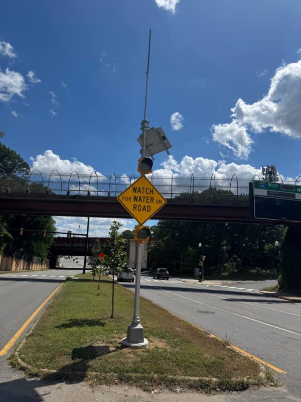
Arlington deployed High Water Detection Systems with flashers, gates, and alerts to help reduce the risk of vehicles entering flooded streets during storm events.
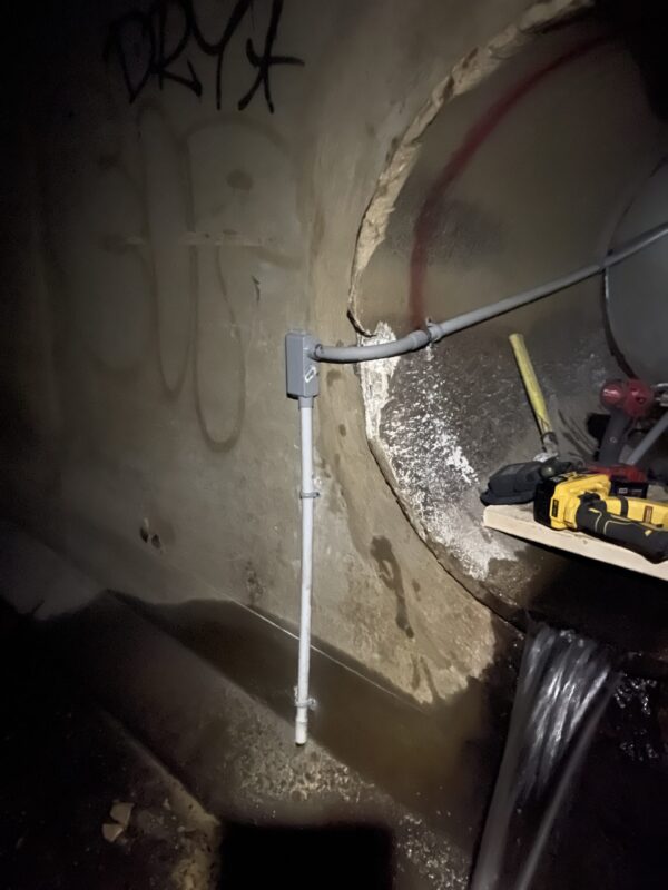
Monitoring stations were installed near watershed outfalls and known problem areas, providing the real-world measurements Arlington needs to calibrate stormwater models with greater confidence.
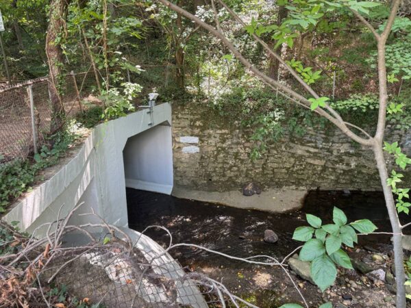
At locations like Columbia Pike, the County installed sensors both at street level and within culverts—improving situational awareness above ground and within the drainage system.
Arlington uses AEM’s monitoring and alerting software to centralize sensor data, support real-time alerts, and provide County-branded dashboards that help teams monitor conditions at critical flood-prone locations.
By expanding its monitoring network and improving access to real-time observation data, Arlington County is building a stronger foundation for safer roadways, more accurate modeling, and smarter long-term drainage investment.
Arlington’s experience demonstrates how localized observation—paired with centralized visualization and alerting—can help communities move beyond assumptions and toward more proactive, data-driven flood preparedness.

