Axiom Fire Data Logger
The Axiom Fire F7 Data Logger enables RAWS systems to provide actionable intelligence for wildfire monitoring, detection, and response while standing up to the demands of long-term off-grid deployments.
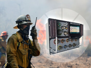
The Axiom Fire F7 Data Logger enables RAWS systems to provide actionable intelligence for wildfire monitoring, detection, and response while standing up to the demands of long-term off-grid deployments.

Data collection you can rely on to protect the community from fires, even in extreme conditions.
Simplified configuration via full-color touchscreen reduces field time and maximizes uptime.
Designed for evolving needs, diverse monitoring goals, and networks of any scale or maturity stage.
We provide the technology that community leaders and wildfire response professionals need to protect people, property, and precious resources from the growing threat of major wildfires. The Axiom F7 Data Logger is a dedicated wildfire data logger that gets the information wildfire teams need to make a difference from the field and in front of monitoring professionals in real time.
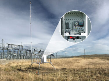
RELIABLE wildfire risk data
The Axiom F7 Data Logger is designed specifically for critical wildfire weather network building and has been tailored based on decades of learnings from the field. RAWS networks powered by AEM stations provide the backbone of the world’s biggest and widest used wildfire intelligence centers, including the National Interagency Fire Center (NIFC) and Canadian Interagency Forest Fire Center (CIFFC).

Real-time intelligence for fire weather monitoring
Wildfire monitoring, management, and response professionals can’t settle for data that’s limited by the electric grid or cell phone coverage. That’s why the Axiom F7 Data Logger uses satellite telemetry to extend wildfire monitoring into remote high-risk areas. Depending on application and project goals, the Axiom Fire can leverage either the NOAA’s Geospatial Operational Environmental Satellite (GOES) or private Iridium satellites to provide reliable off-grid telemetry.
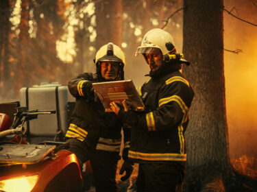
Actionable intelligence for wildfire professionals
The Axiom F7 Data Logger and RAWS fire weather stations provide a foundation of actionable data that fire monitoring, detection, and response professionals can use to create better outcomes in their area. Using AEM Elements™ 360 software, agencies can visualize wildfire intelligence in the field together in real time to improve response coordination and accelerate assessment and mitigation.
To remain aware of where they face the greatest wildfire risk, Ventura County officials have created and continue to expand a network of Remote Automated Weather Stations (RAWS). But network expansion poses a chicken-and-egg problem for the county: how do you identify new at-risk when you don’t already have a fixed RAWS at the site to collect the necessary data? This is the story of how they've solved that problem.
ESS is helping the Country Fire Authority (CFA) of Victoria, Australia better manage wildfire risk with fixed and portable versions of AEM's weather stations. Learn how the stations are helping the CFA improve its understanding of wildfire behavior, fill in gaps in Australia's weather monitoring, and enhance the safety of prescribed burns.
In general, a data logger is a device that records data being observed by one or more sensors. A wildfire data logger like the Axiom Fire is specifically designed to capture and communicate environmental data that’s relevant for wildfire monitoring and risk assessment applications, such as humidity, wind speed and direction, fuel moisture, and rainfall.
The Axiom serves as the dedicated logger for the AEM Remote Automated Weather Station (RAWS). In terms of sensors that can be attached as part of that system, there’s a wide range of possibilities. The F7 model has four SDI ports that can be used with an incredible variety of sensors in addition to dedicated connections for temperature/humidity, fuel moisture, and rainfall.
The National Oceanic and Atmospheric Administration (NOAA) operates the GOES satellite to provide telemetry for weather forecasting, storm tracking, and meteorological research projects. Iridium Satellite Communications is a publicly traded satellite communications company based in Virginia. They operate a constellation of more than 75 satellites that creates a global communication network. If you’re doing public safety related work in North America, the GOES satellite is a good fit. If you’re outside North America or doing private sector work, Iridium is the way to go.
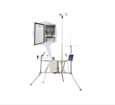
Get exceptionally accurate wildfire weather data. Our Remote Automated Weather Stations are trusted in some of the world’s harshest locations.
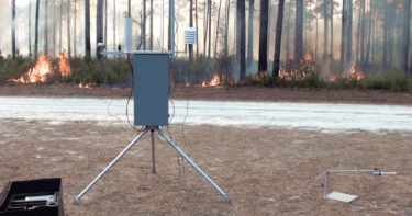
As the top choice of the fire community, the QD RAWS delivers critical hyperlocal data for prescribed burns and temporary fire monitoring applications.

AEM Elements 360 is a multi-hazard weather intelligence solution and the cornerstone of the Elements Resiliency Platform.